

In this scenario, the RadMap control is placed inside a RadDocking pane. The exception is raised when you click and hold the mouse on a drawn polygon. Then the mouse is released outside of the Form. When closing the tab holding the map, an exception is thrown.

When Windows 11 Dark themes are applied the Legend items panel back color is not changed. This behavior is observed in the following themes:
- Windows11Compact11Dark
- Windows11Dark
- Windows11HighContrast
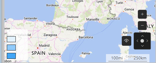
In this scenario, the reported behavior is observed in NET 8. The same behavior is not reproducible in .Net Framework 4.8. When the map is zoomed max out and we try to pan the view, missing tiles appear and the performance is very slow. Additionally, in the output tab of VS, we can observe some exceptions:
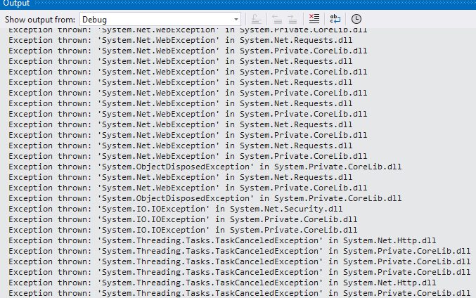
In this case, we have missing image tiles while zooming and scrolling the map. When downloading a tile, the internal WebClient is returning an error with the following message: The server committed a protocol violation. Section=ResponseStatusLine. The WebException does not have a Response. This scenario is not handled in code which will lead to missing image tiles. Zooming the same area will reload the missing tiles, but still, it should be handled in the source code.

To reproduce:
- Create a shape with QGIS and add it to RadMap using the approach described in the documentation: http://docs.telerik.com/devtools/winforms/map/file-readers/esri-shapefile-reader
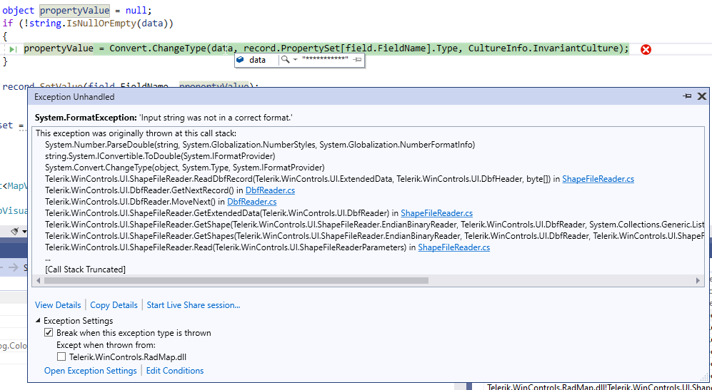
The ShapeFileReader fails in its ReadDbfRecord method:
            using (MemoryStream shapeStream = new MemoryStream(File.ReadAllBytes(@"C:\Users\dyordano\Downloads\84aa4699-f436-4b7e-b029-e353fdab0411_shapefile-before-modification\asseuappareil.shp")))
            {
                using (MemoryStream dbfStream = new MemoryStream(File.ReadAllBytes(@"C:\Users\dyordano\Downloads\84aa4699-f436-4b7e-b029-e353fdab0411_shapefile-before-modification\asseuappareil.dbf")))
                {
                    ShapeFileReaderParameters parameters = new ShapeFileReaderParameters();
                    parameters.ShapeStream = shapeStream;
                    parameters.DbfStream = dbfStream;
                    ShapeFileReader reader = new ShapeFileReader();
                    List<MapVisualElement> elements = reader.Read(parameters);
                }
            }
Hi
We would like to use vector tiles in our offline mapping applications, like ones you can get here :- https://openmaptiles.com/downloads/dataset/osm/europe/great-britain/england/#5.03/52.946/-2.426
I think telerik only supports raster files right now. Is there any plans to support vector files in the future? Could it be added to the roadmap?
(I am not looking for a way to convert vector files into PNG/Bitmap/JPEG Image tiles in a custom provider thanks)
- HitTest(PointG location)
- HitTest(PointL point)
- HitTest(Point location)
However, if the layer is not visible, its IsVisible property is set to false, the HitTest(PointL point) will not return the clicked pin, but the HitTest(PointG point) method will return it. This behavior is not consistent and all overloads should consider whether the layer is visible or not.
Hello,
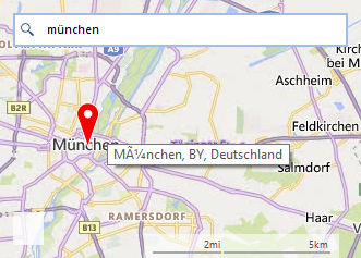
on a german Windows, when searching with the bingmapsprovider for "München",
the tooltip on the Pin doesn't shows the ü in the correct way.
Hi,
Please refer. below code...
        void ShowInfoUI()
        {
            var padding = new Padding(0);
            var font = new Font(Font.FontFamily, 8.0f);

            if (T.InfoLayer.IsVisible = cbShowInfo.Checked)
            {
                var overlays = T.PinsLayer.Overlays;

                for (int i = 0; i < overlays.Count; i++)
                {
                    var callout = new MapCallout(overlays[i]) { Font = font, Padding = padding, Text = "1234567", Distance = 5 };

                    T.InfoLayer.Add(callout);
                }
            }
        }
There are 2 layers, InfoLayer (MapCallout) and PinsLayer (MapPins). cbShowInfo controls if MapCallout tobe shown.
If the 'Text' length is less than 8 wrapping happens, and not otherwise. Usually, If Text length is more then wrapping should happen.
Thanks
So it might be useful if PointG (and PointL, RectangleG, RectangleL, SizeG, SizeL) value types also implement it. There are so many articles about its advantage. The reason is I want to use LINQ queries on a PointG collection, GroupBy, Distinct, etc... so it will be better optimized.
Please refer.
https://medium.com/@semuserable/c-journey-into-struct-equality-comparison-deep-dive-9693f74562f1
The Epilogue part specifically.