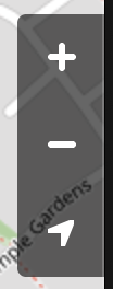
under the class k-map-controls k-pos-top k-pos-left
like the navigator and zoom controlls. I like to add some specified Button with my own events like an mylocationBtn something like this..
If I set a global font icon type, the Map icons are broken, because they are missing the k-font-icon CSS class. A possible workaround is to apply the missing styles to the rendered k-icon class:
In the meantime, one can use SVG icons or the following CSS rule as a workaround:
    .k-map .k-icon {
        width: 1em;
        height: 1em;
        outline: 0;
        font-size: 16px;
        font-family: "WebComponentsIcons";
        font-style: normal;
        font-variant: normal;
        font-weight: normal;
        line-height: 1;
        speak: none;
        text-transform: none;
        text-decoration: none;
        flex-shrink: 0;
        display: inline-flex;
        flex-flow: row nowrap;
        align-items: center;
        justify-content: center;
        vertical-align: middle;
        position: relative;
        -moz-osx-font-smoothing: grayscale;
        -webkit-font-smoothing: antialiased;
}Hello
Is it possible to get the map to support Geolocation? Something like whats on the openstreetmap website map where you can click the location button and the map then moves to where your location is. Maybe some event that we can listen on to get the Latitude and Longitude of the users location which we can then use to manipulate the map?
Phil
Using a custom SVG icon in a Marker template causes the Map component to break and throw an exception (Failed to execute 'appendChild' on 'Node': Unexpected end of input) in WASM application.
In the meantime, the alternative approach to achieve custom map markers is to use Font Icons. An example of the approach can be found in this REPL link.
Hello,
I have a Dialog that contains a Coordinates textbox which when focused shows a Popup with a Map.
The Map does not show the tiles until I manually zoom or pan.
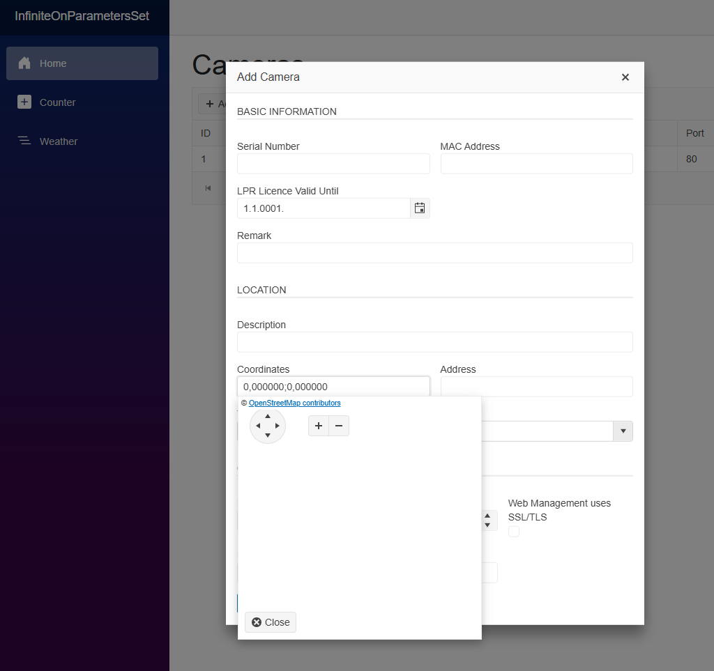
Description
The arrow buttons in the Map's navigator and the zoom buttons render without type="button" attribute.
Steps To Reproduce
Inspect the navigator and zoom buttons in this demo: https://demos.telerik.com/blazor-ui/map/overview
Actual Behavior
The buttons render without the type attribute.
Expected Behavior
The buttons render with type="button" attribute.
Browser
All
Last working version of Telerik UI for Blazor (if regression)
No response