Recently Updated
Completed
Last Updated:
22 Jun 2022 12:15
by ADMIN
ADMIN
Created by:
Ianko
Comments:
0
Category:
Map
Type:
Bug Report
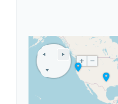
Different CSS is applied over the markers when opened in mobile device. Which enlarges the marker elements and the rendered positions appear incorrect.

The temporary fix is to reset the marker elements to their original size and position:

 @media only screen and (-webkit-min-device-pixel-ratio: 2), only screen and (min-device-pixel-ratio: 2) {
     .k-map span.k-marker{
         width: 28px;
         height: 40px;
         margin: -40px 0 0 -14px;
     }
 }
Won't Fix
Last Updated:
20 Jun 2022 14:35
by ADMIN
ADMIN
Created by:
Ianko
Comments:
0
Category:
Map
Type:
Bug Report
When the map is set to e.g. Zoom=1 the world map shows as continued sequence of the same layout.

All markers set on the map should appear on all correct places, so that the user could zoom out and pan outside the center view port and still be able to see the markers.
Won't Fix
Last Updated:
20 Jun 2022 14:07
by ADMIN
ADMIN
Created by:
Ianko
Comments:
0
Category:
Map
Type:
Bug Report
FeatureCollections can have a collection of features in which the GeometryCollection type provides the coordinates of multiple geometries.

The above matter should be fully supported, but in RadMap the geometries in the geometry collection does not render.
Completed
Last Updated:
01 Jun 2021 13:45
by ADMIN
Release Q1 2015
ADMIN
Created by:
Ianko
Comments:
0
Category:
Map
Type:
Bug Report
The following error occurs after the partial post back:

Error: Sys.InvalidOperationException: Two components with the same id 'RadMap1' can't be added to the application.


You can resolve this by using the RadScriptManager instead of native ScriptManager control.
Completed
Last Updated:
24 Mar 2021 14:14
by ADMIN
Release R1 2021 SP2
Created by:
Telerik Admin
Comments:
0
Category:
Map
Type:
Bug Report
Replicable in Overview demo - https://demos.telerik.com/aspnet-ajax/map/examples/overview/defaultcs.aspx?skin=Material
Completed
Last Updated:
29 Jul 2019 11:29
by ADMIN
Created by:
Mark
Comments:
2
Category:
Map
Type:
Bug Report
When the Map position is not on the top of the page, creating a new marker via the OnClick event argument location, the marker is not correctly positioned.
Completed
Last Updated:
17 Dec 2014 14:45
by ADMIN
ADMIN
Created by:
Ianko
Comments:
0
Category:
Map
Type:
Bug Report
This error is due to missing configuration option for the Bing layer. The settingsUrl property of layer options could be used to fine tune the URL and modify it to request data from SSL enabled URL and resolve the mixed content issue.

To resolve the issue, you can configure this property on the OnInitialize event and the options of the Map, exposed by the arguments:

<telerik:RadMap runat="server" ID="RadMap1">
    <LayersCollection>
        <telerik:MapLayer Type="Bing" Key="YOUR BING KEY"></telerik:MapLayer>
    </LayersCollection>
    <ClientEvents OnInitialize="OnInitialize" />
</telerik:RadMap>

<script type="text/javascript">
    function OnInitialize(sender, args) {
        var options = args.get_options();
        options.layers[0]["settingsUrl"] = "https://dev.virtualearth.net/REST/v1/Imagery/Metadata/#= imagerySet #?output=json&jsonp=bingTileParams&include=ImageryProviders&s=1&key=#= key #";
        args.set_options(options);
    }
</script>